
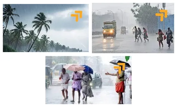
Well, it looks like it’s time to pull out the raincoats and umbrellas! The weather forecast for Andhra Pradesh is in, and it promises some significant downpours over the next few days. Both the Amaravati and Visakhapatnam Meteorological Centres have confirmed that many parts of the state will see widespread rain for about five days, starting from today, July 18th. So, let’s dive into what you can expect in your region.
Key Highlights
- ✓ A five-day rain alert has been issued for Andhra Pradesh, from July 18 to July 21, 2025.
- ✓ The Indian Meteorological Department (IMD) forecasts moderate to very heavy rainfall across many districts.
- ✓ Strong gusty winds are expected, reaching speeds of 40-50 km/h in several areas.
- ✓ The State Disaster Management Authority (SDMA) has issued a public alert, urging residents to take precautions.
- ✓ A low-pressure system in the Bay of Bengal and a surface trough are causing this widespread rainfall.
A Statewide Alert: What's Behind the Weather?
You might be wondering why we're suddenly seeing such an intense forecast. According to the weather experts, this is happening due to a combination of factors. There’s a surface circulation brewing, along with a trough that extends from West Vidarbha to Karnataka. This weather system is what's bringing all this moisture and leading to the prediction of widespread, and in some cases, very heavy rains across the state.
It’s not just about the rain, either. The forecast also warns of thunderstorms with lightning and strong, gusty winds. We're talking about wind speeds hitting between 40 and 50 kilometers per hour. This is a significant weather event, and it's not limited to just our state; neighboring Telangana has also been experiencing heavy rainfall for the past couple of days, with Hyderabad getting a proper drenching.
The Day-by-Day Forecast (July 18 - July 21)
Alright, let's break down what the next few days look like across the different regions of Andhra Pradesh. The intensity and timing will vary, so here’s a closer look at what to expect in your area. This information comes directly from the official bulletins, so it's best to be prepared.
Friday, July 18th: The Rains Begin
The rain has already started in some places. On Friday, moderate to heavy rains are expected in the coastal districts of NTR, Guntur, Bapatla, Palnadu, Prakasam, and Sri Potti Sriramulu Nellore. Meanwhile, the Rayalaseema region, including districts like Kurnool, Nandyal, Anantapur, Sri Sathya Sai, YSR Kadapa, Annamayya, Chittoor, and Tirupati, is set to experience scattered thunderstorms with moderate to heavy showers.
For those in North Andhra, particularly in Srikakulam, Vizianagaram, Parvathipuram Manyam, and Alluri Sitharama Raju districts, the forecast is for light to moderate rains accompanied by thunderstorms. Other areas like Dr. B.R. Ambedkar Konaseema, Eluru, and Anakapalli also saw some light to moderate rainfall.
Saturday, July 19th: Brace for Heavy Downpours
Saturday is when things are expected to really pick up. A wide-ranging forecast for moderate to heavy rain has been issued for a large number of districts. The list is long, so check if your area is on it: Srikakulam, Vizianagaram, Parvathipuram Manyam, NTR, Guntur, Bapatla, Palnadu, Sri Potti Sriramulu Nellore, Prakasam, Kurnool, Nandyal, Anantapur, Sri Sathya Sai, YSR Kadapa, Annamayya, Chittoor, and Tirupati are all expected to get significant rainfall.
Additionally, coastal districts like Eluru and Krishna are also on the list for moderate to heavy spells. It seems Saturday will be the day to stay indoors, catch up on a good book, and listen to the sound of the rain from the safety of your home.
Sunday, July 20th: The Rain Continues
The wet weather pattern continues into Sunday. The forecast predicts light to moderate rains, along with thunderstorms, across a vast stretch of the state. This includes Kakinada, Konaseema, East Godavari, West Godavari, Eluru, Krishna, NTR, Guntur, Bapatla, Palnadu, Prakasam, Sri Potti Sriramulu Nellore, and nearly all the Rayalaseema districts like Kurnool, Nandyal, Anantapur, Sri Sathya Sai, YSR Kadapa, Annamayya, Chittoor, and Tirupati. The remaining districts are likely to see lighter showers.
Monday, July 21st: More Rain on the Horizon
The IMD has extended the forecast to Monday, with more moderate to heavy rains on the way. A specific alert has been mentioned for the East Godavari district in North Andhra, which could see some particularly heavy spells. It's clear that this rainy spell is here to stay for a little while longer, so it's a good idea to plan your week accordingly.
Staying Safe: Official Advice from the Authorities
With a forecast like this, safety is obviously the top priority. The Andhra Pradesh State Disaster Management Authority (SDMA) has been very proactive in getting the word out. Their key message is for everyone to remain vigilant and take necessary precautions throughout this period of heavy rainfall.
Dr. B.R. Ambedkar, the MD of the SDMA, has issued specific instructions. He advises people to stay away from anything that could be a hazard in strong winds and rain. This includes large billboards, weak or old buildings, and standing under trees, which can be dangerous during thunderstorms. The general advice is to stay indoors as much as possible and only venture out if it is absolutely essential. Let's make sure we all listen to the experts and stay safe.
Conclusion
So, there you have it. Andhra Pradesh is in for a very wet and windy few days. From the coastal belts to the plains of Rayalaseema, almost the entire state is covered by this rain alert. Remember the dates: July 18th through the 21st, with Saturday and Sunday looking particularly intense. Please pay close attention to the warnings from the IMD and the SDMA. It’s always better to be safe than sorry, so take the necessary precautions, keep an eye on the weather updates, and stay dry out there!

💬 We'd love to hear your thoughts! Join the charcha—keep it friendly, fun, and respectful.